Tuesday, March 6
Our first day was a long one. As
you may have noted from the map page, the route from Chicago to
Shanghai takes a polar route that goes pretty far up in latitude.
The trip I took to Tokyo last year took a similar path but it was night
and when it wasn't it was cloudy so there wasn't much to see. This trip
is all daytime and the weather was generally good, so I'm giving you a
view of what it looks like up in the Great White North.
We flew over Mackinac island heading North:
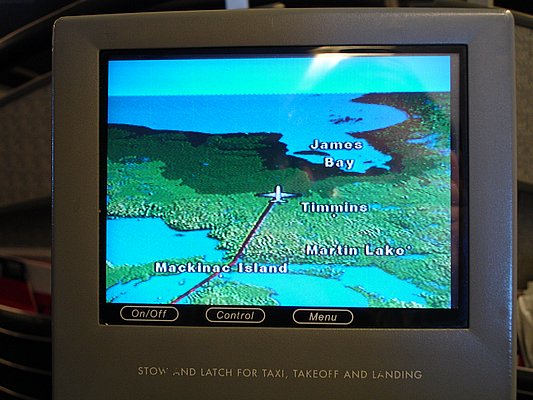
Our routing (according to Flightaware) took us at least up to 80°N 105°W. Along the way we flew northeast to Canada up to James Bay:

Where it looked like this;


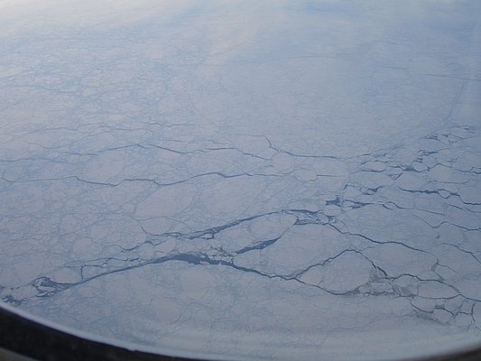
A bit further north things were cold and more solid but still somewhat broken:


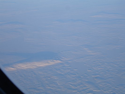
Even further north over Baffin Island you can see the snowpack is pretty complete but the mountains do extend above:


As we near the North Pole, since there's no land up there, it's snow and ice as far as you can see. It also started to get a bit darker but the sun never did go completely down.

The evidence of occasional cracks is obviously proof of global warming...


It pretty much looked the same for the next several hours. We still had another 8 hours to go... We're now over the International Date Line, so on to March 7...
We flew over Mackinac island heading North:
Our routing (according to Flightaware) took us at least up to 80°N 105°W. Along the way we flew northeast to Canada up to James Bay:
Where it looked like this;
A bit further north things were cold and more solid but still somewhat broken:
Even further north over Baffin Island you can see the snowpack is pretty complete but the mountains do extend above:
As we near the North Pole, since there's no land up there, it's snow and ice as far as you can see. It also started to get a bit darker but the sun never did go completely down.
The evidence of occasional cracks is obviously proof of global warming...
It pretty much looked the same for the next several hours. We still had another 8 hours to go... We're now over the International Date Line, so on to March 7...